
All Geography & GIS Related Tutoring Subjects:
Software -->> Introductory & Applied ESRI ArcGIS Pro
Explore New Maps, Manipulate Spatial Data, &
Master Leading Software Used by Geography Professionals
-- $60/hr on Average --
Pay-As-You-Go :: No Contracts
(All prices contingent upon unique goals and material)
Pay-As-You-Go :: No Contracts
(All prices contingent upon unique goals and material)
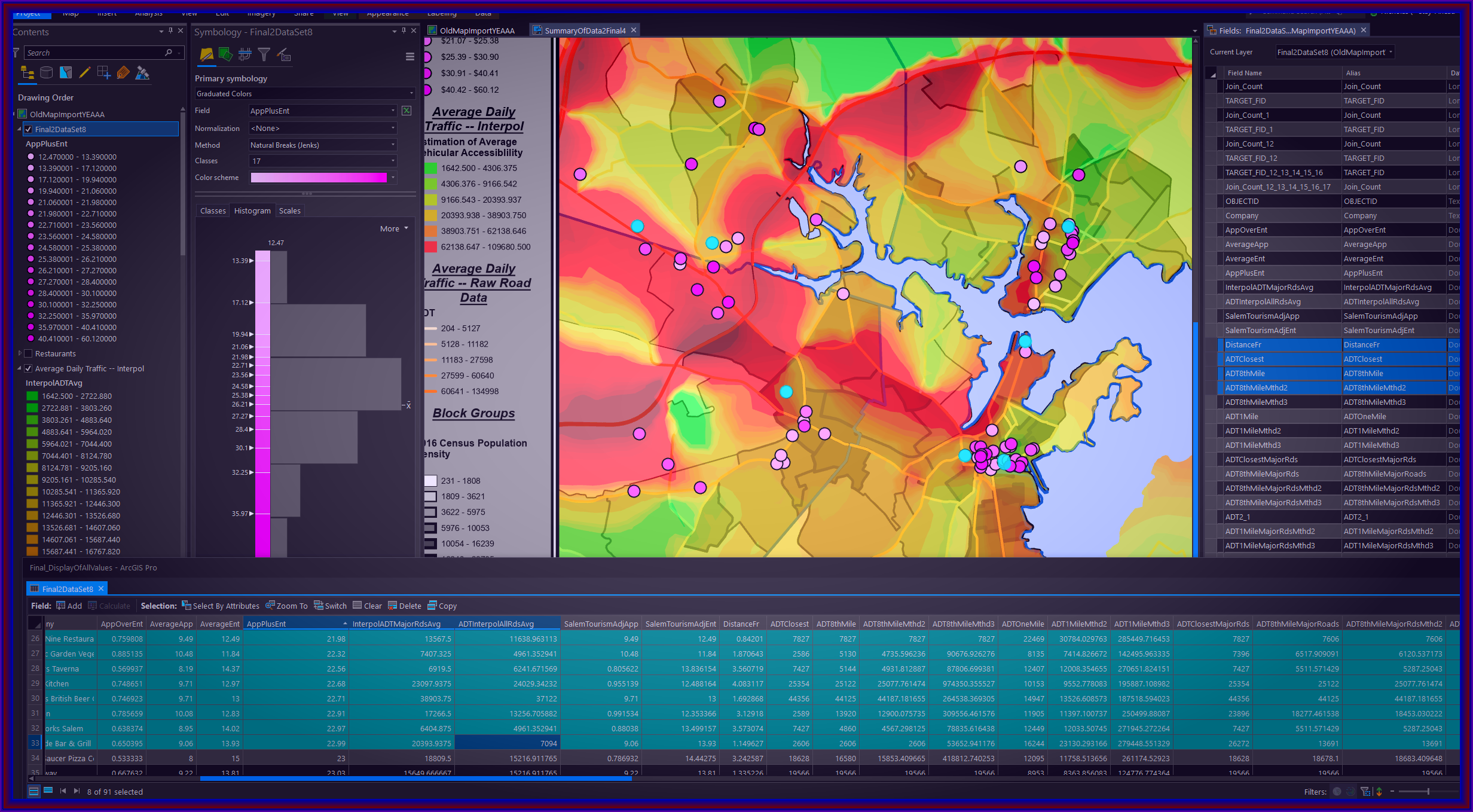
ArcGIS Pro (formerly ArcGIS Desktop), created by ESRI, is the leading professional desktop application used in the GIS industry. Let Stay Ahead Tutors lead you step-by-step in completing maps with this software, applying anything from introductory GIS skills to professional cartographic presentations. ArcGIS tutoring includes assistance managing and installing the application, introductory spatial analysis, building important file-type management and organizational habits, and developing a general comfort while using this powerful and complex application.
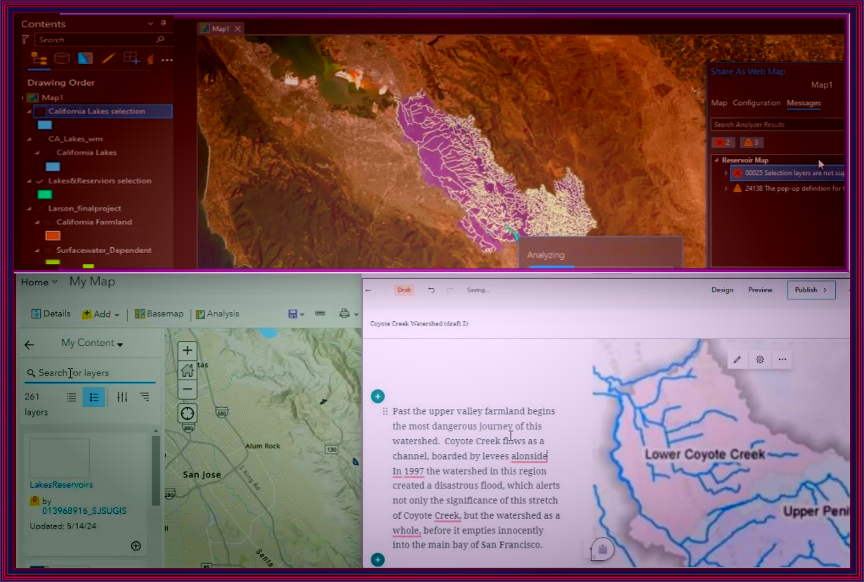
Software -->> ESRI Online / Storymaps
Create Comprehensive Projects Using ESRI's Online Interfaces &
Complete Research Presentations with ESRI Storymaps.
-- $65/hr on Average --
Pay-As-You-Go :: No Contracts
(All prices contingent upon unique goals and material)
Pay-As-You-Go :: No Contracts
(All prices contingent upon unique goals and material)
Many students and professionals must apply their skills exclusively in ESRI's online, cloud-based software. Similar to ArcGIS Pro, ArcGIS Online has a difficult to understand file organizational system and a unique user interface. ArcGIS Online tutoring can help with all web applications provided online by ESRI (including storymaps), allowing you to create impressive published final reports incorporating your maps and any geography-related aesthetics.
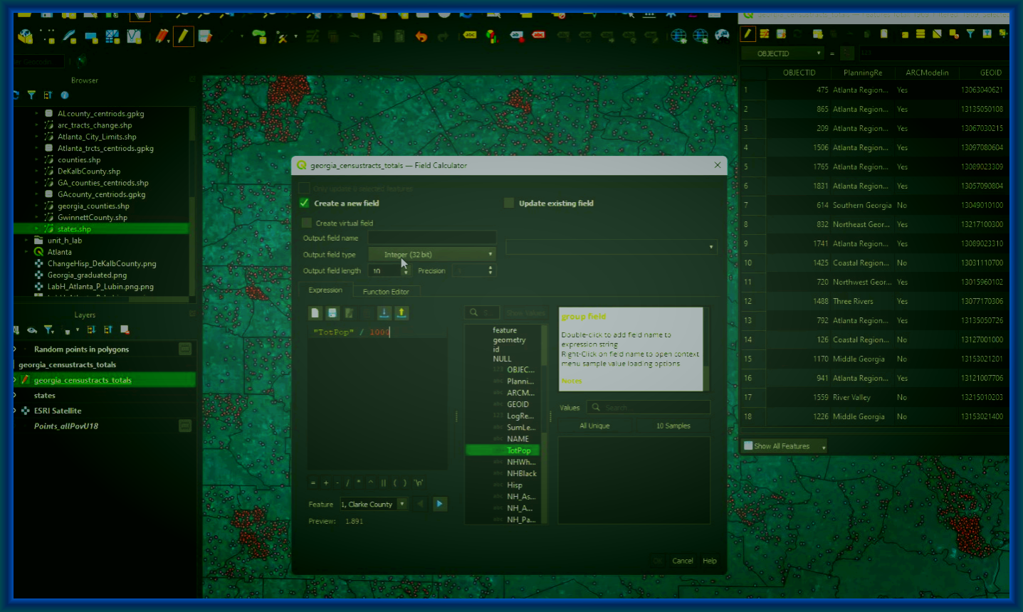
Software -->> Introductory & Applied QGIS & GeoDa
Discover Best Practices Using Independent, Community-based Geographic Software Alternatives
-- $70/hr on Average --
Pay-As-You-Go :: No Contracts
(All prices contingent upon unique goals and material)
Pay-As-You-Go :: No Contracts
(All prices contingent upon unique goals and material)
Free-to-use and open-source QGIS tutoring is becoming very popular both professionally and as a GIS/spatial analysis teaching platform. Allow Stay Ahead Tutors to guide you through this powerful application. In addition, GeoDa tutoring is available; while GeoDa is not as versatile as QGIS from our experience, we are ready to apply and teach this software to anyone who might require it!
Geographic Research & Applied Cartography
Explore More Advanced Cartographic Topics &
Build Expansive Research Projects Applying Advanced Spatial Analysis & Geography
-- $65/hr on Average --
Pay-As-You-Go :: No Contracts
(All prices contingent upon unique goals and material)
Pay-As-You-Go :: No Contracts
(All prices contingent upon unique goals and material)
Geography research tutoring can incorporate advanced cartographic techniques including elaborate quantitative spatial analyses and careful attention to ensuring visually accurate aesthetics. Get help polishing your final professional or academic research with QGIS, ArcGIS Pro, or any other geographic design tools. Let Stay Ahead Tutors assist in acquiring the ideal geographic data and apply it to comprehensive maps perfect for displaying your research's methodology.
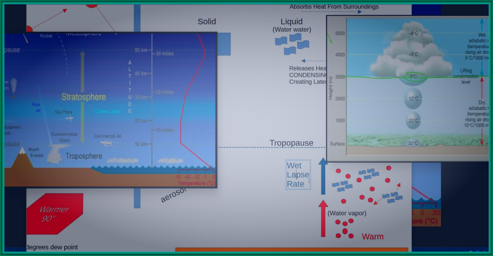
Sustainability & Climate Studies
Build A Comprehensive Understanding of Weather &
Climate While Incorporating Sustainable, Geographic Principles
-- $60/hr on Average --
Pay-As-You-Go :: No Contracts
(All prices contingent upon unique goals and material)
Pay-As-You-Go :: No Contracts
(All prices contingent upon unique goals and material)
Incorporating the sciences of biology, chemistry, and meteorology, environmental science tutoring is one of Stay Ahead Tutors' specialties. Climate tutoring and sustainability tutoring is commonly a part of a core curriculum within many universities. It can also be taught as a more advanced subject in many undergraduate and graduate geography degrees.
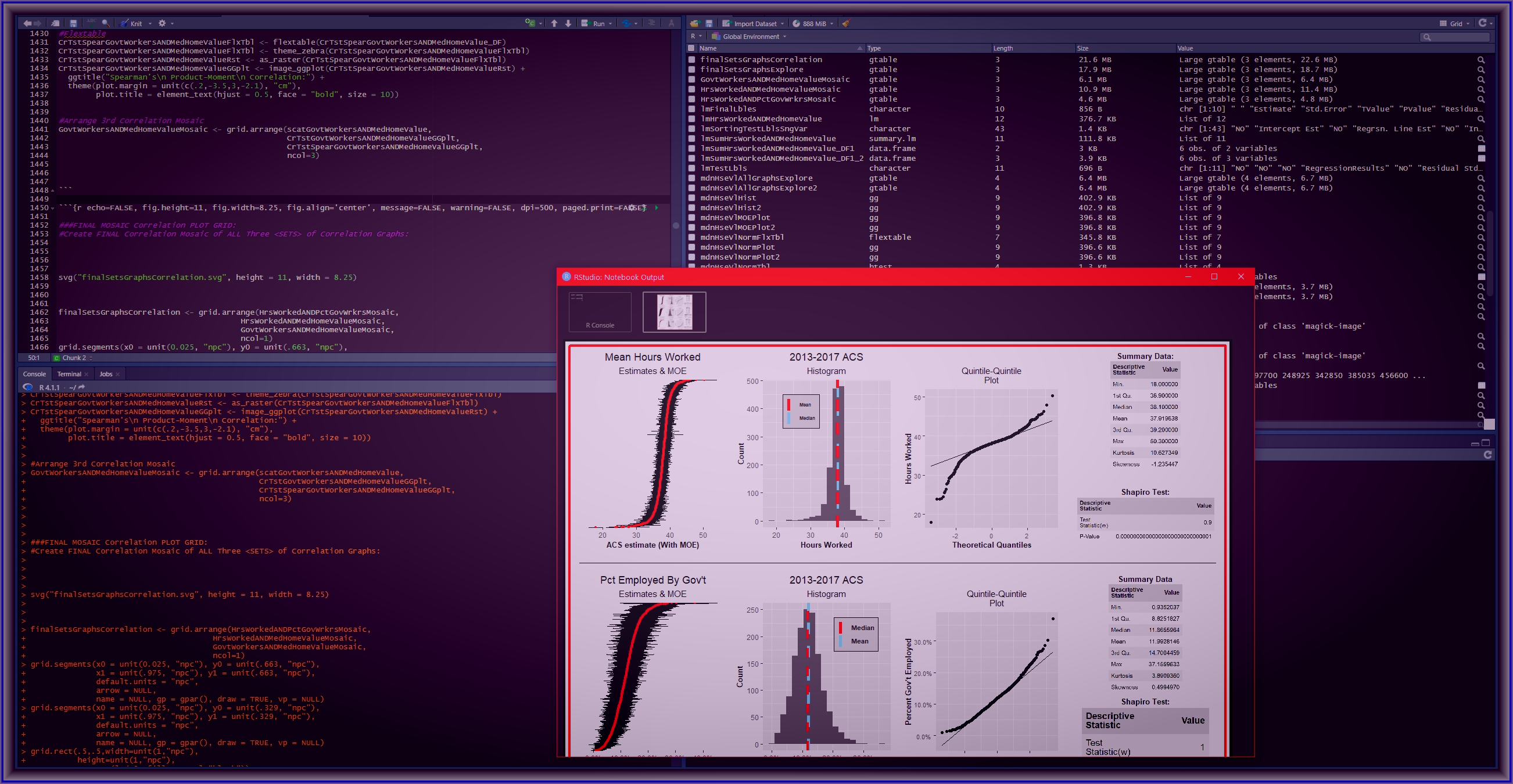
Intermediate & Advanced Spatial Modeling & Analysis
Apply Advanced Spatial Analysis Incorporating Various Software Packages
& Statistical Techniques
-- $75/hr on Average --
Pay-As-You-Go :: No Contracts
(All prices contingent upon unique goals and material)
Pay-As-You-Go :: No Contracts
(All prices contingent upon unique goals and material)
Intermediate to advanced spatial analysis tutoring includes advanced understanding of general statistics, and its unique application to spatial data. Transforming your advanced analyses into an automated process and/or model commonly applies Python or other coding scripts combined with spatial databases. Additionally other software integrated solutions, such as ArcGIS Pro or QGIS modeling tools, are also applied during advanced spatial modeling tutoring.